


Southeast Nebraska PUMA, Nebraska
About
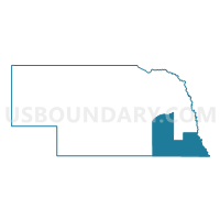
Outline

Summary
| Unique Area Identifier | 193331 |
| Name | Southeast Nebraska PUMA |
| State | Nebraska |
| Area (square miles) | 7,739.48 |
| Land Area (square miles) | 7,694.04 |
| Water Area (square miles) | 45.44 |
| % of Land Area | 99.41 |
| % of Water Area | 0.59 |
| Latitude of the Internal Point | 40.36293420 |
| Longtitude of the Internal Point | -97.20014390 |
Maps

Graphs
Select a template below for downloading or customizing gragh for Southeast Nebraska PUMA, Nebraska


Neighbors
Neighoring Public Use Microdata Area (by Name) Neighboring Public Use Microdata Area on the Map
- Central Nebraska PUMA, NE
- Dodge, Cass, Saunders & Washington Counties PUMA, NE
- Lancaster County--Lincoln City (North) PUMA, NE
- Lancaster County--Lincoln City (South) PUMA, NE
- North Central Kansas--Salina City PUMA, KS
- Northeast Kansas PUMA, KS
- Northeast Nebraska PUMA, NE
- Northwest Missouri PUMA, MO
- Shawnee (Outside Topeka City), Osage, Jackson, Brown & Wabaunsee Counties PUMA, KS
- South Central Nebraska PUMA, NE
- Southwest Iowa--Council Bluffs City PUMA, IA
Top 10 Neighboring County (by Population) Neighboring County on the Map
- Lancaster County, NE (285,407)
- Dodge County, NE (36,691)
- Platte County, NE (32,237)
- Cass County, NE (25,241)
- Gage County, NE (22,311)
- Saunders County, NE (20,780)
- Seward County, NE (16,750)
- Otoe County, NE (15,740)
- Saline County, NE (14,200)
- York County, NE (13,665)
Top 10 Neighboring County Subdivision (by Population) Neighboring County Subdivision on the Map
- Beatrice city, Gage County, NE (12,459)
- York city, York County, NE (7,766)
- Nebraska City city, Otoe County, NE (7,289)
- Seward city, Seward County, NE (6,964)
- Crete city, Saline County, NE (6,960)
- Falls City city, Richardson County, NE (4,325)
- Fairbury city, Jefferson County, NE (3,942)
- Auburn city, Nemaha County, NE (3,460)
- Columbus township, Platte County, NE (3,160)
- David City city, Butler County, NE (2,906)
Top 10 Neighboring Place (by Population) Neighboring Place on the Map
- Beatrice city, NE (12,459)
- York city, NE (7,766)
- Nebraska City city, NE (7,289)
- Seward city, NE (6,964)
- Crete city, NE (6,960)
- Falls City city, NE (4,325)
- Fairbury city, NE (3,942)
- Auburn city, NE (3,460)
- David City city, NE (2,906)
- Geneva city, NE (2,217)
Top 10 Neighboring Unified School District (by Population) Neighboring Unified School District on the Map
- Lincoln Public Schools, NE (260,793)
- Columbus Public Schools, NE (23,264)
- Beatrice Public Schools, NE (14,588)
- Waverly School District 145, NE (11,304)
- Seward Public Schools, NE (10,431)
- Crete Public Schools, NE (10,116)
- Nebraska City Public Schools, NE (9,241)
- York Public Schools, NE (9,028)
- Norris School District 160, NE (9,020)
- Schuyler Community Schools, NE (8,316)
Top 10 Neighboring State Legislative District Lower Chamber (by Population) Neighboring State Legislative District Lower Chamber on the Map
- State House District 4, MO (35,512)
- State House District 97, IA (27,696)
- State House District 63, KS (22,789)
- State House District 62, KS (20,162)
- State House District 106, KS (19,150)
- State House District 109, KS (18,283)
Top 10 Neighboring State Legislative District Upper Chamber (by Population) Neighboring State Legislative District Upper Chamber on the Map
- State Senate District 12, MO (169,332)
- State Senate District 1, KS (69,919)
- State Senate District 21, KS (61,803)
- State Senate District 49, IA (60,560)
- State Senate District 25, NE (48,973)
- State Senate District 21, NE (44,532)
- State Senate District 23, NE (40,859)
- State Senate District 30, NE (39,073)
- State Senate District 15, NE (36,691)
- State Senate District 22, NE (35,193)
Top 10 Neighboring 111th Congressional District (by Population) Neighboring 111th Congressional District on the Map
- Congressional District 2, KS (710,047)
- Congressional District 6, MO (693,974)
- Congressional District 1, KS (655,310)
- Congressional District 1, NE (626,092)
- Congressional District 5, IA (577,453)
- Congressional District 3, NE (561,378)
Top 10 Neighboring Census Tract (by Population) Neighboring Census Tract on the Map
- Census Tract 104, Lancaster County, NE (7,821)
- Census Tract 9606, Saline County, NE (7,518)
- Census Tract 9648, Colfax County, NE (6,516)
- Census Tract 101, Lancaster County, NE (6,030)
- Census Tract 9682, Saunders County, NE (5,485)
- Census Tract 9655, Platte County, NE (5,427)
- Census Tract 9603, Seward County, NE (5,099)
- Census Tract 9659, Cass County, NE (4,998)
- Census Tract 9604, Seward County, NE (4,988)
- Census Tract 9698, York County, NE (4,634)
Top 10 Neighboring 5-Digit ZIP Code Tabulation Area (by Population) Neighboring 5-Digit ZIP Code Tabulation Area on the Map
- 68601, NE (28,185)
- 68310, NE (14,546)
- 68467, NE (9,338)
- 68410, NE (8,716)
- 68434, NE (8,576)
- 68333, NE (8,327)
- 68661, NE (7,282)
- 68528, NE (6,285)
- 68524, NE (5,983)
- 68818, NE (5,475)